Israel’s geography is diverse and holds significant historical and cultural importance. Situated in the Middle East on the eastern edge of the Mediterranean Sea, the country is relatively small, yet its terrain encompasses a range of landscapes. The coastal plains along the Mediterranean coastline form a fertile region, known historically as the Plain of Sharon. This area supports agricultural activities and urban development, including major cities like Tel Aviv and Haifa. The coastal region has a Mediterranean climate, characterized by mild, wet winters and hot, dry summers.
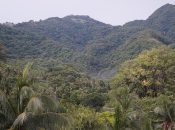
Inland, Israel’s topography transforms dramatically. The central highlands, including the mountain ranges of Galilee in the north and the Samarian and Judean Hills in the center, offer varied landscapes, elevated plateaus, and valleys. Jerusalem, one of the world’s oldest and holiest cities, sits amidst these hills. The region features diverse flora and fauna and serves as a historical and religious focal point.
To the east of the central highlands lies the Jordan Rift Valley, a geological depression that stretches from the Sea of Galilee to the Dead Sea and beyond. The Dead Sea, one of the saltiest bodies of water globally and the lowest point on Earth’s surface, is a unique natural wonder.
Further to the east, the land rises again into the arid and rugged landscape of the Negev Desert. This vast desert region covers over half of Israel’s land area, characterized by dry, rocky terrain and extreme temperatures. Despite its harsh conditions, the Negev showcases unique ecosystems and ancient archaeological sites.
Israel’s diverse and captivating geography, extending from the fertile coastal plains to the rugged highlands and arid deserts, stands as a cornerstone of the nation’s natural allure. Beyond its aesthetic charm, this varied terrain holds profound significance in Israel’s historical narratives, cultural identity, and agricultural endeavors.

Dead sea in Israel
Let’s take a look at these 18 interesting facts about Israel geography to know more about it.
- Diverse Landscapes: Israel’s geography encompasses coastal plains, highlands, valleys, and a desert, offering a range of landscapes within its relatively small area.
- Mediterranean Coastline: The country has a 273-kilometer coastline along the Mediterranean Sea, home to vibrant cities, beaches, and fertile plains.
- Coastal Plains: The coastal plains, such as the Plain of Sharon, are fertile regions supporting agriculture and urban development.
- Central Highlands: The mountainous regions, including Galilee, Samarian Hills, and Judean Hills, feature elevated plateaus and valleys, hosting historic cities and religious sites.
- Jordan Rift Valley: This geological trench runs through Israel from north to south, housing the Sea of Galilee and the Dead Sea, the lowest point on Earth’s surface.
- Dead Sea: Known for its high salt content and buoyancy, the Dead Sea is a unique natural wonder and a popular tourist destination.
- Negev Desert: Covering over half of Israel’s land area, the Negev Desert boasts rugged terrain, arid landscapes, and unique flora and fauna.
- Mountains of Israel: Mount Meron is the country’s highest peak, while Mount Hermon, in the Golan Heights, often sees snowfall in winter.
- Water Resources: Israel utilizes innovative technologies for water management, including desalination plants, recycling, and drip irrigation, crucial in water-scarce regions.
- Biblical Landmarks: Many geographic features in Israel hold biblical significance, attracting religious pilgrims and tourists.
- Greenery and Conservation: Efforts to restore forests and conserve natural habitats have resulted in the rehabilitation of areas like the Carmel Forest.
- Geological Diversity: The country has diverse geological formations, including limestone cliffs, volcanic landscapes, and canyons.
- Geopolitical Significance: Israel’s strategic location in the Middle East has contributed to its geopolitical importance throughout history.
- Border Diversity: The country shares borders with Lebanon to the north, Syria to the northeast, Jordan to the east, and Egypt to the southwest.
- Seismic Activity: Israel experiences occasional seismic activity due to its location along the Dead Sea Transform fault system.
- Biodiversity: Despite its small size, Israel boasts a rich variety of plant and animal species due to its diverse ecosystems.
- Environmental Challenges: The country faces environmental challenges like desertification, water scarcity, and conservation concerns.
- Cultural Significance: Israel’s varied geography not only shapes its natural beauty but also influences its history, culture, and religious significance.
Israel’s geography is a testament to nature’s diversity encapsulated within a relatively small territory. From the fertile coastal plains along the Mediterranean to the rugged highlands and valleys steeped in history and religious significance, the country’s landscape embodies a remarkable blend of scenic beauty and cultural richness. The geological wonders of the Jordan Rift Valley, housing the extraordinary Dead Sea, and the vast expanse of the Negev Desert, with its unique ecosystems, highlight the contrasts within Israel’s borders. This diverse geography not only shapes the nation’s natural splendor but also plays a pivotal role in its historical narratives, cultural heritage, and ongoing efforts in environmental conservation and innovation. In its varied terrains lie stories of civilizations past and present, serving as a testament to the resilience and vibrancy of a land deeply intertwined with history and heritage.